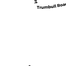
11 TRUMBULL RD
Owner Information
STUBBS SUSAN L & BARRY
13 TRUMBULL RD
NORTHAMPTON, MA 01060


Property Details
11 TRUMBULL RD is classified as a Three-Family Residential (1).
The primary structure on this property was built in 1900. There are 1,257ft2 of built area within this property. There is 3,785ft2 of residential/living space within this property. This property is listed as having 15 rooms. There are 3 units within this property.
11 TRUMBULL RD is valued at $592,300. The land is valued at $180,700 and the structures are valued at $411,600. There is an additional valuation of $50,270 on this property.
11 TRUMBULL RD was last sold on Sunday, March 1, 1998 for $295,000.
Assessment data from fiscal year 2020.
Flood Data
According to the FEMA National Flood Hazard Layer, this property does not appear to be in a flood zone. It may also be in an area not yet reviewed. Nonetheless, confirm this information prior to taking any action.
To view the flood hazards around this property, create a FEMA "Firmette" Map of the area around 11 TRUMBULL RD.
Broadband Internet Providers
| Provider | Type | Bandwidth (mbps) | |
|---|---|---|---|
| Viasat Inc | Satellite | 100 | 3 |
| VSAT Systems, LLC. | Satellite | 2 | 1 |
| HughesNet | Satellite | 25 | 3 |
| GCI Communication Corp. | Satellite | 0 | 0 |
| T-Mobile | Fixed Wireless | 25 | 3 |
| Comcast | Cable | 1000 | 35 |
| Verizon New England Inc. | DSL | 15 | 1 |
| Crown Castle Fiber | Fiber | 0 | 0 |
Broadband service provider data from December 2020.
Adjacent Properties
- 9 TRUMBULL RD
Apartments with Four to Eight Units owned by WOLPIN ERIC N - 110 KING ST
Mixed Use (Primarily Commercial, some Residential) owned by MELNIK PATRICK J JR & ZOE B ZEICHNER - 100 KING ST
General Office Buildings owned by DENNY JEFFREY A & SUSAN S - 100 KING ST
General Office Buildings owned by SWERDLOW-BRANDT JOAN & - 100 KING ST
General Office Buildings owned by GAUBINGER ANN CLEAVELAND TRUSTEE - 100 KING ST
General Office Buildings owned by ALDRICH GARY L - 100 KING ST
General Office Buildings owned by VERSON PAULA - 12 BRIGHT ST
Single Family Residential owned by PARKER SHELLEY K - 13 TRUMBULL RD
Two-Family Residential owned by STUBBS SUSAN L & BARRY S GOLDS